Hiking Blacklock Point
Odometer- rusting-'er resting
Trip Meter 8 miles
June 8th, 2014- Port Orford, OR
Today, Mark Lankford is taking me to the hiking trails north of Port Orford in Floras Lake State Park.

The trail we are taking this morning is the one to Blacklock Point, a headland on the Pacific coast just north of Cape Blanco. Cape Blanco is the western-most point in Oregon and almost the western-most point in the continental US just behind Cape Alava, Washington by about .13 minutes of longitude or about 800 feet.

The flowers were all in mid-bloom this morning. We saw Rhododendron...


Clover and daisies

Did I mention beautiful yellow and blue iris??

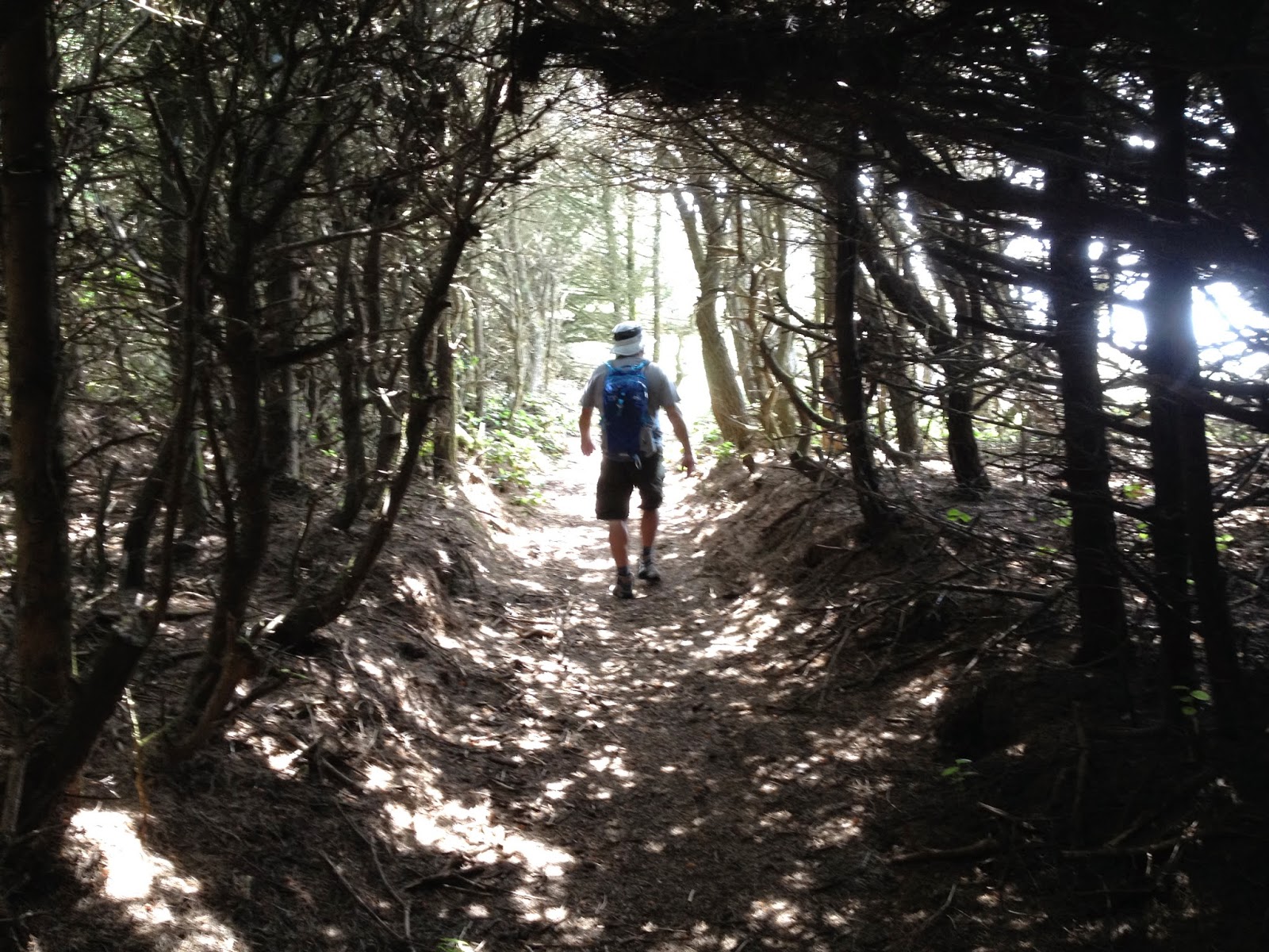
The trail was inland and paralleling the ocean beach on our way north. At first the trail looked wide enough to have been a road at one time, then the "road" petered out and the trail become very narrow. In the picture above, the trail is only about a foot wide and surrounded for hundreds of feet by dense salal.

After hiking a couple of miles north we were able to turn west on a trail over to the top of the bluffs overlooking the ocean.

From here, we had a clear view up the coast as far as the eye can see- Bandon, OR is off in the hazy distance
At times the shore trail was completely canopied by shore pines that knit together above our heads.


We headed south along the coast and came to a look-out where we could see Blacklock Point.
This area came into prominence back in 1886 when John Blacklock established the Blacklock Sandstone Mining Company here. During it's two years of operation here, enough sandstone had been shipped to build 18 public buildings in San Francisco, including the Hall of Justice, Union Ferry Building, Mutual Savings Bank, and the Hamilton Alexander Hotel- all of which withstood the 1906 earthquake and fires.

A commercial pier was established as well as railroad tracks for flat cars which hauled massive 10 ton blocks of granite carved from the sandstone bluffs, out to waiting ships. Almost no sign of the enterprise exists today- we saw only one 25 foot section of rails that were wedged between two large boulders out on the rocky point, but we could not get down to them safely, to investigate further.

Your Traveling Friends
Jeff and Joan


Comments
Post a Comment