Friday, November 30, 2012

Odometer 25,951 miles

Trip meter 74 miles

Benson, AZ

November 30, 2012

Why Benson? Well it's on the cut-off to State Hwy 80 to Tombstone and Bisbee, two high interest sites in SE Arizona. We really don't like driving through major cities, and Tucson is no exception to this rule. That's why we stayed in North Tucson to see the Biosphere2 and why we breezed through Tucson without stopping to get to Benson and camp overnight Thursday and Friday. I say we breezed through, however we did want to make one stop at Camping World to get another pressure regulator for the water hookup- one like the one I inadvertently left behind attached to the faucet in Las Vegas. We had a backup unit, but it was too restrictive. We learned that low pressure and low flow can be, but are not necessarily linked together. Valterra makes a line of regulators that gives 15-20% more flow at less than 40psi, and that was what we were after. This Camping World store is INCREDIBLE! It has more stuff in stock than anywhere we've seen before and we've see a lot of RV stores. Needless to say, we broke our budget going in for a $16 dollar item and leaving an hour later, with $95 worth of treasure.

Back on the road again, we were in Benson within an hours time. After setting up camp and having lunch, we loaded up the car and drove 27 miles south on route 80 to see the historic old west town of Tombstone. It's Touristy- yeah, but we wanted a little whimsy with our history. Here's what we saw:

3 blocks of old town are barricaded for walking only. When you step past the barricade, you step back in time to 1881. There are many actors in period dress and all the shopkeepers were in period garb.
You could take a ride in the stage coach and the driver would tell you all about the history of the town. (we didn't)

One particular store I was fascinated with, had period weaponry that were all replicas of the real thing, from guns, to knives and swords.

Joan caught me checking out the action on a Colt 45 six shooter- it felt absolutely real, the cylinders revolved, the hammer would cock and fire with a trigger pull and it felt very heavy. In the end I couldn't for the life of me decide why I needed one.

Next up is a picture of the front of Big Nose Kate's Saloon.

Kate was the common law wife of Doc Holliday, friend of Wyatt Earp. Throughout the time we were there, gunfighters roamed the streets drumming up business for the "Gunfight" at the OK Corral. Admission $10/person- we were way over our budget and declined.

We were very interested in one modern aspect of this old town. These were the first solar electronic compacting trash cans we'd ever seen

This is not a joke or a gimmick- this is the real thing, with photo-voltaic cells on the top to power it.

On Friday we drove further south on Route 80 to about 12 miles from Mexico to the Historic mining town of Bisbee. We had called ahead yesterday to make reservations for a tour of the Queen Mine.

Bisbee is a very interesting and unique.town that is situated in a very steep gorge at 5,538 feet in the Mule Mountains.

The whole downtown has been kept to period style, which is a mixture of Victorian and Art Deco, with a little Mexican adobe.
We signed up at the Queen Mine to take a tour into the old mine shafts.
You've got to get dressed for the 47 degrees and pitch dark
We each got slickers, a hard hat, and a light that we wore on a strap around our neck.

We rode what looked to be an actual crew car 1800 feet into the mountain.

It was a little spooky because the shaft is very narrow- they warn you not to wave or point with your arms, because we pass very close to the vertical timbers in the shaft.

"Blondie" as our tour guide calls her steals the show with the dynamite stick.

Okay- big fascinates me, and it rarely gets bigger than this. Another open pit mine- this one called the Lavender Mine, not having anything to do with the colors actually but named for the first General Manager.
Nice color in the water down at the bottom eh? Anyone for a chemical swim?

Joan loved the look of these brick stairs.

We had lunch in the Savory Spot cafe just below the house that was serviced by the brick stairs. The patio was semi shady and a very pleasant place to rest and by 2 in the afternoon- we were hungry.
Joan takes this alleyway as a short-cut between the two main streets.

On to New Mexico tomorrow

Jeff and Joan

Wednesday, November 28, 2012

Odometer 25877

Trip Meter Zero

Tucson, AZ

Wednesday November 28, 2012

Today the motorhome stayed put in Tucson at the Valley of the Sun RV Park while we drove the 45 miles out to Oracle, AZ and the Biosphere2 project. By now you know we don't exactly get an early start so we found ourselves doing household chores and finally getting underway at 10:30. While we are on the subject, I should give you a thumbnail sketch of what a typical day is like for an RV traveler. Our mornings are typically just like yours, we just get to do everything a little more leisurely. After showers and dressing we throw open the shades on all the windows to embrace the morning sun. Next the sun shows up all the dirt tracked in the day before (and all the popcorn that hit the floor) so sweeping is a daily regimine, followed by a wet Swiffer every other day. I should mention that this is our third "bus" (my nomenclature for the motorhome or MH) and all of them have had some variation of carpet and vinyl or carpet and hardwood in the front end and carpet in the bedroom. Well let me tell any of you that don't know- what is outside gets tracked inside, no matter how careful you are. Therefore we decided early on, to tear out the carpet and install vinyl flooring. Vinyl floors make the cleaning process much easier when you get back into the bus from a fuel stop and realize you have diesel or worse-yet grease on your shoes!

One part of this life that doesn't take long to get used to is that like you- we prepare and eat breakfast- the difference is- we get to actually finish our cup of coffee instead of throwing 1/3 of it down the sink and rushing off to work, or carrying it to the car and hoping not to spill it on the way to work! (Sorry but isn't it true?).

Having a home that bounces down the road, over speed bumps, and pot holes, means that things come loose, wear out, or fail completely. So some part of the day is set aside for replacing drawer glides, re-stringing blinds, washing, waxing the exterior, checking tire pressures, repairing faucets, checking fluid levels, adjusting exterior mirrors- well you get the idea. I'll expound on this more in the future- what you want to know is what Biosphere2 is like.

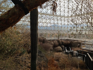
The Biosphere is called Biosphere2 because Earth is Biosphere1. To make this human experiment as accurate as possible the researchers had to first build an extremely tight envelope that would seal off BS2 from the Earth's environment. In fact this vessel is tighter even than the space shuttle. The BS2 has over 7 million cubic feet of space inside 6,500 sealed glass windows.

The Sphere is designed around 3 main climate zones. There is one section devoted to an equatorial rainforest
One section is an ocean with a million gallons of water and an adjustable wave maker. It is stocked with sea creatures and sea plant life.
The last section is devoted to a desert, where the climate can be changed to match the seasons and the rainfall can be varied to test the stress on the plant life.
The whole ecosystem is supported by a basement level with acres of equipment in the way of pumps, air handlers, chillers, heaters, water filters and other essentials
One of the most fascinating features of the Biosphere is the giant "lung" as they call it. The lung is their word for the expansion chamber that allows the atmosphere to heat up and expand during the day without exploding the exterior glass shell. This expansion chamber has a rubber-like membrane with a 6 ton aluminum disk in the center. As the air heats and expands the disk lifts off the legs that support it on the floor and it can rise as much as 52 feet to contain the "extra" volume of heated air. As the air cools and contracts the lung exhales air back into the domes.
There have been two well known experiments done here with human occupation. The first was from 1991 to 1993 when 4 men and 4 women (all single and unrelated) lived in the biosphere for two years and 20 minutes. A second experiment was done later where 5 men and two women occupied the sphere for 6 months. All the rest of the time the sphere has been used for ecological studies some sealed and most not. The interior is still kept mostly as it was, but now that the University of Arizona has been given the facility the interior is being changed to support new research. The annual energy costs have run 1 million dollars a year. Last year the university took out sections of glass and installed louvers in specific areas- which has cut energy costs in half.

Tomorrow is a travel day. We will save a lot of Tucson's attractions for another time, as we expect we'll be through here often in our travels. We are debating whether to stop in Benson and drive the car down to Tombstone, or drive on further to Silver City. I may not know the answer until we roll out the driveway tomorrow!

Tuesday, November 27, 2012

Odometer 25877 miles

Trip meter 141 miles

November 27, 2012

Today we uprooted from Ajo and rambled down highway 86 east toward Tucson. We stopped in the small town of Why, Arizona to take a picture of this cute sign:

Our goal for today was to tour the Kitt Peak National Observatory and then to skirt up the west side of Tucson and get set up in a park on the North side of town, in preparation for an excursion to Biosphere2 north and east of Tucson tomorrow.

80 or so miles from Ajo we got our first glimpse of Kitt Peak, and Joan snapped this photo from the windshield as we drove along. Kitt Peak is just right of the fog line on the road. Before the photo was down sized for the blog you could actually see the observatory

There is a 12 mile road from Hwy 86 up to the top of Kitt Peak, and the elevation gain is from desert floor to a lofty 6,875 feet. Even though the road to the top is a very good paved road, we had no intentions of taking the motorhome up, so we pulled into a gravel lot off Hwy 86 and parked the MH to uncouple and take the Honda to the top. I should mention that, as usual, we got off to a lazy start this morning. By the time we had showers, ate breakfast, checked and replied to e-mails, and got everything stowed and the car hooked up- we pulled out of Shadow Ridge RV park at 11:30 AM. Hey- we're retired! We actually intended to get going in time to arrive for the last guided tour of Kitt Peak at 1:30 PM- and that was now in jeopardy as we had 90 miles to cover in just under 2 hours, including the parking and unhooking the Honda, and driving the winding road to the top. As it turned out even though we were late getting there we were able to join the group as they left the visitor's center. It's a good thing we were able to join the tour, as the tour guide was very informative, and entertaining and it made our day. This next photo helps to indicate how huge the main observatory is. There are 10 large hexahedrons that anchor the structure, and our guide said they are over 100 feet tall. While being trucked up the mountain these structures occasionally had to be lifted off the truck and craned around the tighter corners in the road.
The peak is on tribal lands of the Tohono O'odham Nation. It is leased by the National Science Foundation and run by an association of universities. Kitt Peak is the largest and most diverse gathering of astronomical instruments in the world. It is available to science and research groups and now houses 24 optical and two radio telescopes
This last observatory is a strange one- Built in 1962, it is still the largest unobstructed solar telescope in the world with a focal length of 82 meters. Most of that nearly 250 feet of focal length is dug into a shaft in the mountain!
In publishing this blog, I have re-sized the photos I include to make the blog load up more quickly on your browser. Please let me know if the resolution is too low and I can make them a little more dense.

I am pleased to say that the dividers we put in our cabinets in Ajo, worked very well. When we arrived here in Tucson this evening- nothing tumbled out as we opened the cabinet door- better than that- in stayed where we put it! Progress!

I am also pleased that I am gaining a little more control over the page layout in this blog. The whole thing is done in Hypertext Markup Language (HTML) and to even get a paragraph break, one has to enter in the proper HTML symbol. My earlier posts were all run together, because I was seeing spaces and paragraphs in my draft and they did not stay that way when I hit the publish button to send it to the web.

The iPad that Joan and I purchased last June has been proving indispensible. The photos taken today were all taken with the iPad, and I am able to publish this blog tonight only because I can "tether" my laptop to the iPad to get onto the internet, as we often do when there is no wifi available at the park we stay in.

Good night all-

Jeff and Joan

Monday, November 26, 2012

Odometer 25736.

Tripmeter zero.

Ajo, AZ.

Monday, November 26, 2012.

Okay, we know we've been talking a lot about the desert and if that bores you we understand and you should skip ahead 'cause we're really fascinated by the majesty of this dry wilderness. Joan and I drove the 10.5 mile loop road around the Ajo mine and it is impressive to see the tailing piles 100 feet tall and miles around. The area is mostly Mine owned property on the mine side of the loop road and BLM on the other. We really like the look of this little desert home tucked into the slope of the hill

The hills are peppered with these beautiful, prickly, Cholla cactus. There are about 6 varieties of this cactus that grow in Arizona. This particular one is called Club Cholla
The Ocotillo cactus shown below, looks like a sprig of thorny stems most of the year, turns green and leafy with beautiful red flowers after a heavy rain.
After scaling the peak above the mine for a photo opportunity to see down into the mine- Jeff found a much easier photo op from the mine overlook. As a small extension of the museum, the mine overlook has a small one-room building filled with all manner of photos, and diagrams of how the mill looked as the years progressed. One exhibit that floored us was a panoramic photo of the Ajo valley taken from a high ridge in 1916! This incredible photo is a full 36" long and as crisp and clear as a digital image.
We asked Bob Hightower, a 30 year employee of the Phelps Dodge Mining Company why the company would build such an elaborate town center and high school. He explained it this way. To keep the best miners the company had to keep the wives and children happy while the miner slaved away 10 hours a day 6 days a week.
Jeff has been having some fun building some lightweight dividers for some of the cupboards in the coach to keep things from falling out on us after bumping down the road for several hours. He started out using thin paneling and a glue gun, but has since moved on to using 1/8 hardboard. We'll have to let you know how this works out.
Tomorrow we hit the trail again. We plan to take 86 East towards Tucson stopping at Kitt Peak National Observatory, and then Biosphere2 if we still have time.

Friday, November 23, 2012

Odometer 25736 Trip 0 Ajo, AZ Friday, November 23, 2012 Black Friday! The words sound humorous to us in the Sonoran desert 120 miles from any big box store. We are still in Ajo, Arizona, and will be for several more days as we relax and enjoy this delightful little desert town. Yesterday (Thanksgiving day) I slipped out the door at 11 AM to take what I guessed would be a short hike up to the top of a rocky ridge above town where I could get some panoramic photos of the area and to see all the way to the bottom of the giant open pit mine that was the genesis of Ajo. Several years back an acquaintance living in the RV park had indicted where the “trail” to the peak of Camelback mountain (elev 2573’ or about 800 feet above the park).
I set off walking up the road hoping I would remember or recognize the starting point. About a mile up the road I decided I would try an unmarked trail heading in the general direction of the ridge. I should mention that there is a very substantial cross at the peak erected in honor of John Campbell Greenway a former General Manager of the mine who was beloved by all the townspeople. Greenway was recruited by the corporate owners to layout the town site, and make plans for the first large open pit copper mine in Arizona. The cross was erected shortly after Greenway’s death in 1926. I looked up and said to my self- How hard could it be if they took or built a 12 tall cross up there? My thought was that the trail would go to the ridge and follow the ridge up to the highest peak. Well, after scaling the ridge, I found that the trail went back down the other side to the mine. The mine is fenced off on the side facing town and there is no easy way to get up close- so I hiked back down and walked over to the edge of the pit and snapped some photos. I still wanted to get my panorama of the town and mine so I started up the ridge again in a slightly different spot thinking I would intercept the trail- wrong! At the top of the ridge there was no trail, and now I know how this spot got the nickname Camelback. The ridge undulates up and down 3 more times before I get to the prominence I wanted.
Did I mention the desert is full of spiny things that injure you if you get too close? The going was slow as I chose my footing carefully in the loose granity soil and rock. Somewhere along here I found I’d lost the lens cap for my Canon SLR! Okay- I’m cheap and I liked the original Canon cap- so off I went backtracking the precious progress already made, back down to the mine rim where I’d snapped the last photo. No joy- I didn’t find it on the way down or on the way back up again. Okay I thought- once I get to the cross I’ll be able to see the path down and it will be smooth sailing. I had told Joan I would be back in plenty of time to shower and get dressed for Thanksgiving dinner at the RV park club house at 3 PM. It was now 12:30 and I had two more prominences in this ridgeline, and since there was no trail, I may as well side-hill to the saddle of the last and tallest peak. To hasten what is already too long a story, I summited at the cross snapped my photos.
Here you can get an idea of the depth of the mine 750- 1000 feet deep
Here is the picture I wanted of Ajo (actually only part of it) showing the mine tailings in the background. The cross turns out to be cast in concrete and very substantial. I am very impressed, and wonder how it was made and erected here. I suspect a helicopter but not sure they could have afforded one in 1926. I love technology! I called Joan on the phone to have her come out in the street in front of the motorhome and wave at me. It is more than a little after 1 PM, and I told Joan I have found the trail and I’ll be coming down the front side of the ridge and would she meet me at the museum road in 20-30 minutes with the car. HA! No trail here either, what I thought was a path peters out into nothing, and it’s so steep, I’m zig-zaging to keep from falling. I stumble out to the road and connect up with Joan- glad for the half mile ride home so I can shower and change clothes and still get to dinner. I’m thinking I’ll pay for this in aching muscles tomorrow.
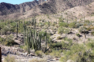
Here is a representation of my route.

Wednesday, November 21, 2012

Odometer 25736 Trip 162 Ajo, AZ Wednesday November 21, 2012 Short trip from Yuma down Interstate 8 to Ghila Bend, then south on State Route 85 to a small desert town called Ajo. Most of the area to the south of the freeway, and both sides of 85 is the Barry M. Goldwater Air Force Range, a huge chunk of Arizona from Yuma 140 miles east toward Tucson and 40 miles wide. 2.7 million acres of the Sonoran Desert. The large size of these training areas is required because modern weapon systems now engage an aggressor from 25 miles or more distant. Other than the signs warning you to stay out- it looks like any other beautiful desert landscape. Speaking of beautiful deserts, as we drew near Ajo we came alongside the Cabeza Prieta National Wildlife Refuge. This is one lush desert compared to what we have been travelling through. We plan to stay here in Ajo for about a week or so and we definitely will be visiting the Cabeza Prieta. On our way across Interstate 8 we passed a huge construction site and a quick check on the web informed us that what we were looking at was one of the largest, if not THE largest solar plants in the WORLD! Right here! 70 miles west of Phoenix in a little tiny town called Gila Bend. When finished it will generate 280 megawatts of electricity- enough for 70,000 homes. I stopped counting at 17 construction cranes- I hope there are a few left for the rest of Arizona’s contractors.
The road from Gila Bend to Ajo is a good one and there was no wind to speak of, so after a brief stop in Gila Bend, Joan took over the driving and I got a chance to really look at the passing scenery. We chose to rent a space in the Shadow Ridge RV Park, it wasn't too adventurous- seeing as how we have been here twice before, once in 2002 and 2006, however we really like this area and this park. It is amazing to think we used to get here and relax and explore and get 1,100 miles back home in just 2 weeks! We have been invited to Thanksgiving dinner at the RV resort clubhouse tomorrow. We originally figured on being in Dallas with Joan's brother and his wife Sally and our niece Savannah. We realized last week that we were travelling much too slowly, so we called to let them know we will still be visiting, just much later.
Jeff grabs a quick nap after a strenuous morning of reading and internet. Joan and I rode down to the main plaza of "downtown" Ajo on the folding bicycles we carry with us in one of the storage bays.
Joan and I were really looking forward to getting another glimpse of the giant open pit mine that is literally on the edge of town. Copper was first discovered here by the Spanish in 1750. Modern mining techniques began to harvest copper, aluminum, gold, zinc, tin, and other rare metals and gems in 1917. By the time Phelps Dodge closed the mine in 1985 the "hole" was an oval 3000 feet by 2,000 feet wide andove 750 feet deep, yielding more than 350 million tons of ore!
We are well acquainted with the docent of the Ajo Mine Museum and we spent a very fascinating hour talking with him about the history of this area. We got to the museum late in the day and there is so much to see and hear we will be back on Friday to chat some more and see the rest of the displays.

Sunday, November 18, 2012

Odometer 25574 Trip 230 Yuma, AZ Sunday November 18, 2012 This post includes two stops. First day took us almost to Parker, AZ and today we rolled into Yuma. We had the idea of stopping at Buckskin Mountain State Park just north of Parker. Some years back we stayed at Cattail Cove State Park, closer to Lake Havasu City, but along the same stretch of the Colorado river, and we enjoyed that stay- So… why not? The weather was perfect, and the park was very nice. We checked in and set up in a river-view spot.
The lake is the reservoir above Parker Dam and it reminds me a lot of the reservoir we used to have above Savage Rapids, near Rogue River. After lunch, we pressed on toward Quartzsite. The road from Buckskin, through Parker follows the river and each turn gave us a glimpse of the Colorado River. As we left Parker we entered the Colorado River Indian Reservation. The highway turns east and then south, which keeps it out of view of the river, At the intersection of 95 south and Interstate 10 I wanted to visit the small town of Quartzite. I really wanted to stay overnight in Quartzite and cruise the huge flea market that runs there every winter. We passed through here in February of 2009 and I marveled at the thousands of items and the 100's of tents and bazaars, but back then we were in a time crunch and couldn't tarry long. This time it would be different- or so I thought. When we arrived I saw that we were much too early and I was told that things wouldn't really get going here until January. There were only a handful of places set-up and it took about an hour to see it all. The area around Quartszite is unique in that is is the only place in Arizona where the BLM will let you buy a permit to camp (boondock) in the desert for an unlimited amount of time. All other BLM lands will allow you to camp for up to 14 days. On our way out of town we saw quite a few RVers taking the challenge and setting up camp in the desert on both sides of the highway. About 30 miles north of Yuma we entered the Yuma Proving Grounds. Signs on both sides of the road warned us not to leave the highway! As most of you already know the Proving Ground is the military testing area for long range artillery, aircraft target acquisition equipment, armor, and wheeled, and tracked vehicles. What you may not know is that the area used to be much larger than it is now. In 1942 General Patton chose the area from Pomona, California 350 miles eastward to Tuscon, Arizona (18,000 square miles) as the California-Arizona Maneuver Area or CAMA. Over 1 million soldiers from more than 400 units have trained here over the years.
Yuma is a city of 93,000. Pretty big by our standards, and the winter season makes it prime time here, so we searched the camp directory for a reasonably priced park to stay in. Joan found us a space at the Friendly Acres RV Park. This place has about 10 short term sites and all the rest are for permanent or semi-permanent residents that either live here full time or return every winter. Job one, when we got set-up at our site was to go out and purchase a new water pressure regulator, because someone who will remain nameless, left his attached to the hose bibb in Las Vegas.

Saturday, November 17, 2012

Odometer 25344 Trip 0 Bullhead City, AZ Friday November 16, 2012 Joan and I visited the small town of Oatman about 20 miles outside of Bullhead City on the Mother Road- Route 66. Oatman is a former mining town in the Black Mountains where gold was found in 1915. The town quickly grew to a population of 3,500 as word of the rich gold finds spread. A disastrous fire in 1921 burned much of the town but fortunately spared the Oatman Hotel which is now one of the oldest two story adobe structures in Mohave county. The present day "downtown" area is about one block long and is lined with restaurants, bars and souvenir shops. But the real attraction of Oatman seems to be the burros that roam the streets of town. The burros once very wild are now somewhat habituated to humans, and will come up to anyone with a handout. We were the guests of house #38 on Snob Hill road just above town. Joan's former co-worker and her husband have retired and purchased one of the few homes available where one can buy the land and house. Most of the town and structures are owned by two enterprising families and most of the structures can be purchased or rented, but the land is leased. Oatman's population is currently less than 130 and many of those, like our hosts are only part year residents, choosing to leave in spring as the temperatures soar, and return in the fall as they moderate again. Joan and I stopped frequently during our drive to and from Oatman to marvel at the desert landscapes. The hills are impossibly steep and rugged and painted rich colors of brown, beige, red and orange, as the light playing across them makes a veritable kaleidoscope of color.
The Black Mountains as seen from Silver Creek Road in Bullhead City
Two rolling stones on the iconic Mother Road
Downtown Oatman is at bottom right. The jagged spire at center is called Elephant's tooth
Rigged for travel. It only feel long when maneuvering in a small parking lot!